
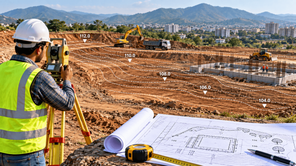
Contour Survey Before Construction: Land Levels & Earthwork
Contour Survey Before Construction: How Land Levels Affect Your Building Project and Earthwork Cost
A plot can look almost flat when you stand on it, but a difference in ground level of even a few points across a construction site can change how the project needs to be planned.
Where should the building sit? How much soil needs to be removed? Where will filling be required? How should surface water move across the site? Will the finished ground level need to be raised?
These questions are difficult to answer accurately by simply looking at the land.
A contour survey before construction gives the design and construction team a clearer picture of the existing ground levels. It can help architects, engineers, developers and contractors make better decisions about site planning, grading and earthwork before construction begins.
What Is a Contour Survey?
A contour survey is a type of land survey used to identify differences in elevation across a site.
The survey records levels at selected points and represents areas having the same elevation through contour lines on a plan. The resulting contour map helps show whether the land is relatively flat, gently sloping, uneven or has more significant changes in elevation.
In simple terms, it answers a question that a normal boundary measurement cannot:
“How does the ground level change across this property?”
This information can be particularly useful before building construction, road development, drainage work, site grading and other engineering activities.
Why Are Land Levels Important Before Construction?
Construction does not happen on an abstract plot shown on paper. A building has to sit on the actual ground.
If the existing land slopes from one side to another, the design and site preparation may need to account for that difference.
For example, one part of a plot may be significantly higher than another. Depending on the proposed building and finished levels, the project may require some combination of:
- Cutting existing soil
- Filling lower portions
- Levelling parts of the site
- Retaining structures
- Adjustments to finished floor levels
- Drainage planning
- Road or access-level adjustments
The exact requirements depend on the site and the project design.
This is why understanding existing levels before construction starts can be more useful than discovering unexpected level differences during excavation.
How Does a Contour Survey Help With Earthwork?
Earthwork generally involves moving soil to achieve the required site levels.
If the existing ground is already close to the proposed levels, less cutting or filling may be required. If there are substantial differences, more earthwork may be necessary.
A contour survey provides the existing-level information needed to understand the terrain.
The survey can therefore help the project team assess where:
- Material may need to be excavated
- Low areas may require filling
- Existing slopes need to be retained or modified
- Access levels need consideration
- The proposed building platform should be positioned
Shradha Land Surveyors also provides earthwork volume estimation for excavation and filling requirements. Combining accurate existing-level information with the proposed design can provide a more practical basis for planning earthmoving work.
Does a Contour Survey Tell You the Exact Earthwork Cost?
Not by itself.
This is an important distinction.
A contour survey provides information about the existing terrain. The actual earthwork quantity and cost depend on several factors, including:
- Existing ground levels
- Proposed finished levels
- Building or road layout
- Cut-and-fill requirements
- Soil conditions
- Required excavation depth
- Disposal or reuse of excavated material
- Filling material
- Equipment and transportation
- Local project conditions
Therefore, a survey should not be presented as a fixed earthwork quotation.
Instead, accurate site-level information can help engineers and contractors make better calculations based on the proposed design.
What Can Go Wrong Without Proper Level Information?
Consider a developer who starts preparing a site based mainly on visual inspection.
The site appears reasonably level, so earthwork begins.
During excavation, it becomes clear that one portion is substantially higher than expected. More material needs to be removed, while another portion may require filling.
This can affect the construction sequence and potentially increase the amount of work involved.
Another example is drainage.
If finished levels and natural ground slopes are not properly understood, the project team may face additional challenges when planning how surface water should move away from the building and across the site.
The lesson is simple:
Understand the existing ground before deciding how to change it.
Contour Survey vs. Basic Land Measurement
These two services are related, but they answer different questions.
| Survey | Main Purpose |
|---|---|
| Land Measurement | Establish dimensions and distances |
| Boundary Survey | Identify or assess property boundaries |
| Contour Survey | Understand differences in ground elevation |
| Engineering Survey | Collect detailed physical information for engineering and construction |
| Layout Marking | Transfer proposed points, plots or features onto the ground |
A project may require more than one type of survey.
For example, a construction project may need boundary information to establish the site limits, an engineering survey for detailed physical features and a contour survey to understand existing levels.
When Should You Get a Contour Survey?
A contour survey is particularly useful before:
Building Construction
Before designing or setting out a building on uneven land, existing ground levels can provide important information for planning.
Site Development
Large residential, commercial and industrial sites may require detailed information about terrain before development.
Road and Access Planning
Changes in elevation can affect proposed access roads, internal roads and other site circulation areas.
Drainage Planning
Understanding the existing slope can help the design team consider how surface water moves across the site.
Earthwork Planning
If substantial cutting or filling is expected, existing-level information is useful for assessing the site before earthmoving begins.
Sloping or Irregular Land
A site that appears difficult to judge visually can benefit particularly from a mapped representation of its elevation changes.
What Does a Contour Map Show?
A contour map uses lines to represent points having the same elevation.
The spacing and pattern of these lines can help indicate the character of the terrain.
For example:
- Closely spaced contours generally indicate a steeper change in elevation.
- More widely spaced contours generally indicate a gentler slope.
- Changes in contour patterns can indicate variations in the shape of the land.
The map provides a visual way for the design and engineering team to understand the existing terrain rather than depending only on observations made at ground level.
Why Professional Surveying Matters
The usefulness of a contour survey depends on the quality and suitability of the field measurements.
Shradha Land Surveyors provides contour surveying as part of its land-surveying services and states that its contour surveys are intended to identify differences in existing land elevation and help design teams make decisions about cutting, filling, widening and levelling.
The company has been providing surveying services for around 20 years and serves areas including Virar, Vasai, Nalasopara, Palghar, Dahanu, Badlapur, Khopoli, Mumbai, Pune and Nashik.
For a construction project, the survey requirement should be discussed based on the actual site, proposed development and intended use of the survey information.
Practical Tip
Do not wait until excavation begins to discover that your site levels are different from what you expected.
If you are planning construction on a sloping, uneven or large plot, consider obtaining the relevant survey information before finalising important site and earthwork decisions.
It is much easier to plan around known ground conditions than to react to unexpected conditions after construction work has already started.
Frequently Asked Questions
Is a contour survey necessary for every construction project?
Not necessarily. The requirement depends on the size, terrain, proposed development and engineering needs of the site. A relatively simple project on suitable flat land may have different requirements from a large or sloping development site.
Can a contour survey calculate earthwork quantities?
A contour survey provides existing ground-level information. Earthwork quantities normally require comparison between existing and proposed levels, so the proposed design and finished levels are also important.
Is a contour survey the same as a topographical survey?
They are closely related but are not always identical in scope. A contour survey primarily represents elevation differences, while a broader topographical survey can include additional natural and man-made features on the site.
Should I get a contour survey before designing a building?
For sites with noticeable slopes, uneven terrain or significant development requirements, obtaining reliable existing-level information early can help the design team make better-informed decisions.
Can contour surveying help reduce unnecessary earthwork?
It can help the design team understand existing terrain and make more informed decisions about building positioning, grading and cut-and-fill requirements. Actual savings depend on the final design and site conditions.
Need a Contour Survey Before Construction?
Planning a residential, commercial or development project and need accurate information about your existing land levels?
Shradha Land Surveyors provides professional contour survey, engineering land survey, land measurement and earthwork volume estimation services for construction and development requirements.
Serving Virar, Vasai, Nalasopara, Palghar, Dahanu, Badlapur, Khopoli, Mumbai and other areas of Maharashtra, the team can assess your site and help identify the appropriate surveying requirement.
Call: 09850264720
Before you start cutting, filling or levelling the land, understand what the ground is telling you.