
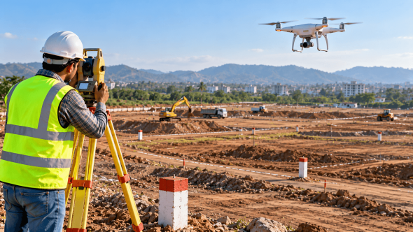
Drone Land Survey vs Traditional Survey: Which Is Better?
Drone Land Survey vs Traditional Survey: Which Is Better for Large Properties and Construction Projects?
This blog post will explore drone land survey vs traditional survey to help property owners, developers, engineers, and construction team in Maharashtra.
The key point is that neither method is always better. Drone surveys can be particularly useful for mapping large areas quickly, while traditional surveying instruments can provide precise ground measurements and setting-out data. Many projects benefit from combining both methods.
Introduction
Choosing the right land survey method can make a significant difference to project planning, site preparation, construction costs, and the quality of technical information available to a project team. For a small residential plot, a traditional ground survey may be sufficient. For a large development site, industrial property, quarry, or road project, drone mapping may provide a much broader view of the terrain.
In Maharashtra, drone-based mapping is also used in planning and land-record initiatives. For example, the Pune Metropolitan Region Development Authority describes using drone surveys and GIS mapping for town planning, road and amenity mapping, land parcels, and encroachment mapping.
PMRDA+1
Understanding the strengths and limitations of each method helps you choose the right approach for your site.
1. What Is a Drone Land Survey?
A drone land survey uses an unmanned aerial vehicle fitted with a camera or other mapping sensor to collect information about a property from above. Specialised software processes the collected data to create outputs such as:
- Orthomosaic maps, which combine aerial images into a detailed map.
- Digital surface models showing visible terrain and objects.
- Contour maps that represent changes in elevation.
- Three-dimensional site models.
- Earthwork and stockpile volume estimates, when the survey method and processing are suitable.
Drone surveying is particularly helpful when the project team needs to understand the overall layout of a large site. Instead of relying only on individual ground measurements, it can capture a dense visual record of the visible surface.
However, the quality of the final information depends on factors such as flight planning, ground control, image quality, terrain, vegetation, and data processing. A drone image alone should not be treated as proof of legal property boundaries.
2. What Is a Traditional Land Survey?
Traditional surveying uses ground-based instruments such as a total station, GNSS/GPS survey equipment, and other appropriate measurement tools. A surveyor visits the property and measures selected points, levels, distances, angles, and site features according to the project’s requirements.
Traditional surveying is commonly used for:
- Measuring plot dimensions and identifying ground features.
- Establishing or checking survey control points.
- Setting out building corners, roads, foundations, and other construction elements.
- Measuring levels and elevations at selected locations.
- Checking physical boundary markers against available survey information.
- Collecting detailed measurements where precise point locations are essential.
A traditional survey is not automatically a legal boundary determination. Where an official demarcation or government-recognised measurement is required, the appropriate procedure and authorised authority must be followed.
3. Drone Survey vs Traditional Survey: Key Differences
| Factor | Drone land survey | Traditional ground survey |
|---|---|---|
| Large-area coverage | Often efficient for broad areas | Can require more time as the area and detail increase |
| Data output | Aerial imagery, surface models and dense mapping data | Selected ground points, measurements, levels and set-out information |
| Terrain visualisation | Useful for viewing the overall site | Useful for measuring specific ground features |
| Construction setting-out | Usually needs ground-based verification and marking | Well suited to setting out precise points on the ground |
| Vegetation and obstructions | Cameras may not see the actual ground beneath trees or covered areas | Surveyors may measure accessible ground features directly |
| Weather and site conditions | Flight and image capture can be affected by weather and visibility | Also affected by site access, visibility and environmental conditions |
| Best use | Broad mapping, terrain visualisation and repeat site documentation | Detailed measurements, control points and construction layout |
Neither method should be selected solely because it is newer or appears faster. The required accuracy, site conditions, intended deliverables, and project purpose matter more. Research on surveying methods also highlights the value of combining aerial data with ground measurements and checks.
MDPI+1
4. When Is a Drone Survey Better for Large Properties?
A drone survey may be a strong option when a project involves a large open area and requires a comprehensive picture of the visible ground surface.
Large land parcels and development layouts: Aerial mapping can help the project team review the overall shape of a property, visible access routes, existing structures, and the arrangement of different site features.
Contour mapping and terrain analysis: Drone-derived surface data can support contour mapping and help identify changes in elevation, provided the data is appropriately controlled and verified.
Earthwork planning: For excavation, filling, quarrying, and material stockpiles, repeat drone surveys can help estimate volume changes. The reliability of these estimates depends on survey control, surface visibility, processing, and the measurement requirements.
Construction progress monitoring: Aerial records collected at different stages can help project teams compare site conditions over time, document progress, and communicate changes to stakeholders.
These benefits can be particularly useful for large sites around developing areas of Maharashtra, where planning teams need a clear overview of terrain and existing features.
5. When Is Traditional Surveying the Better Choice?
Traditional ground surveying remains important when measurements must be taken at specific locations or transferred accurately onto the ground.
For example, a construction team may need building corners marked, foundation locations established, road levels checked, or a particular boundary point measured. A total station or suitable GNSS equipment can be used to collect or set out the required points, depending on site conditions and accuracy requirements.
Ground surveys are also important where aerial imagery cannot reliably show the required information. Dense vegetation, covered drains, narrow spaces, building interiors, and features hidden from the camera may need direct measurement or another appropriate surveying method.
If a property boundary is disputed, do not rely on a drone-generated map alone. Compare the available land records and survey documentation, and arrange the appropriate professional or official boundary-measurement process for the matter involved.
6. Can Drone and Traditional Surveys Be Used Together?
Yes. For many large construction and land-development projects, a combined approach can be more useful than choosing only one method.
A project team might establish ground control using suitable surveying equipment, collect drone imagery across the site, process the data into maps and surface models, and then verify critical points with ground measurements.
This workflow can provide both a broad view of the property and more precise information for specific tasks. It can also support comparisons between planned and existing site conditions.
The Maharashtra land-records context offers a relevant example: research by the Indian Institute for Human Settlements on drone-based city surveys in Maharashtra discusses the importance of combining technologies and ground verification to address the limitations of drone mapping.
IIHS+1
The correct combination depends on the project’s scope, site conditions, accuracy specifications, and required outputs.
7. What Should You Check Before Selecting a Survey Method?
Before appointing a survey service provider, clarify the following points:
- Purpose of the survey: Is it for land measurement, contour mapping, construction planning, earthwork estimation, progress monitoring, or boundary-related work?
- Size and terrain: Is the site open and accessible, or does it have steep slopes, dense vegetation, buildings, and other obstructions?
- Required accuracy: Ask for the accuracy specification and how it will be verified. Do not rely on broad claims without supporting checks.
- Deliverables: Confirm whether you need a site plan, contour map, coordinate data, 3D model, volume report, or construction set-out.
- Ground verification: Establish which points or measurements need to be checked on site.
- Permissions and official requirements: Confirm applicable drone-operation requirements and whether your intended purpose requires an official measurement or demarcation procedure.
These checks help ensure the selected survey method produces information that is actually useful for the project.
Conclusion
Drone land surveying and traditional surveying serve different but complementary purposes. Drone surveys can be highly useful for mapping large properties, visualising terrain, documenting construction progress, and estimating earthwork volumes. Traditional ground surveying remains essential for detailed point measurements, construction set-out, and verification of critical site information.
For many large properties and construction projects in Maharashtra, a combination of drone mapping and ground surveying may provide the most practical solution. The right choice depends on the property’s size, the required accuracy, site conditions, and the decisions the survey needs to support.
Shradha Land Surveyors provides land surveying and measurement services for property and construction-related requirements. Before beginning a project, discuss the site conditions, purpose of the survey, and required outputs with an experienced surveying professional.